Planning & Feasibility
Peat Island & Mooney Mooney — Site Planning & Development Strategy
Category
Planning & Feasibility
Location
Peat Island & Mooney Mooney, Hawkesbury River NSW
Size
Undisclosed
Year
2020
The Project
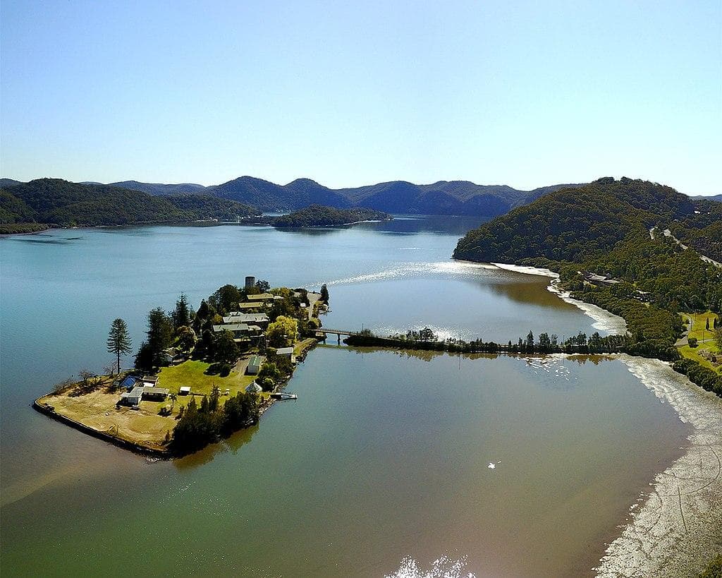
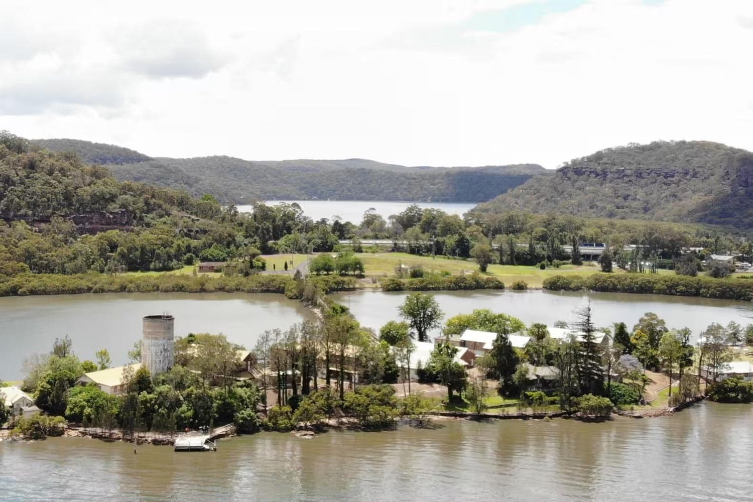
Peat Island is a small heritage island in the Hawkesbury River at Mooney Mooney, connected to the mainland by a narrow causeway. For a century it was the site of a psychiatric hospital, operating from 1911 until closure in 2010. The island sits in a spectacular sandstone gorge, its cluster of Federation-era buildings overlooking the water with the Pacific Highway corridor nearby. Property & Development NSW, in joint venture with Central Coast City Council, engaged a multidisciplinary team to develop a comprehensive planning and development strategy, exploring how the island and surrounding land could be repositioned as a tourism destination and community asset, while addressing the government's divestment objectives.
The Challenge
Few sites in NSW carry as many layers as Peat Island. Heritage significance, sensitive river and bushland ecology, the institutional legacy, and the overlapping interests of State Government, Council, the local community, and Aboriginal stakeholders created a planning environment that demanded real care. This was never about maximising development yield. It required a genuine exploration of what the site could become, one that balanced heritage conservation, ecological sensitivity, tourism potential, community benefit for the broader Mooney Mooney area, and the government's need for a viable divestment pathway.
My Approach
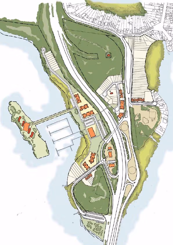
I led a thorough programme of site analysis and environmental due diligence to understand the island's constraints: access limitations, heritage fabric, ecological sensitivities, development potential. Working with specialist consultants, I tested a range of future use scenarios, developing indicative concept plans for both the island and the broader Mooney Mooney precinct. The planning work culminated in the preparation of a site-specific Development Control Plan and Local Environmental Plan mapping, which together provided the statutory framework to guide any future development. I then managed the public exhibition process at both Council and State Government levels, coordinating formal community and stakeholder consultation across multiple interested parties.
The Outcome
The island did not proceed to development. Following the study and exhibition process, the NSW Government divested Peat Island to the Aboriginal Land Trust, an outcome that, while different from the development pathway we had explored, reflects the site's deep significance to the Darkinjung and broader Awabakal peoples of the Hawkesbury region. The planning framework we built, site analysis, DCP, LEP mapping, concept plans, remains as a foundation for any future thinking about the island's long-term use. This project taught me that good planning work has value regardless of whether it leads to construction. Sometimes the most important outcome is clarity about what a site means and who it belongs to. That perspective shapes how I approach every feasibility study at Yaxley Studio.